The climb above Moraine Lake
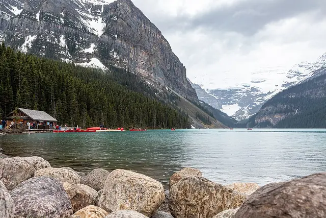
The trail starts at the Moraine Lake shoreline. Within minutes it leaves the turquoise water and the crowds behind, switchbacking up through spruce and subalpine fir. That forest stretch gains most of the height. It is steady, shaded and unrelenting.
Above the trees, Larch Valley opens out. It is a broad meadow ringed by Mount Temple, Pinnacle Mountain and Eiffel Peak, with the two small Minnestimma Lakes sitting on the valley floor. The final push is a series of tight scree switchbacks to the pass itself. Expect loose rock underfoot and almost no shelter from the wind.
What you see from the top
The pass sits at about 2,611 m. It is often described as the highest point reached by a maintained trail in the Canadian Rockies. Facing south, you look back over Larch Valley to the Valley of the Ten Peaks. On the far side, the ground drops steeply into Paradise Valley, past the eroded rock spires below Pinnacle Mountain.
- Distance: roughly 11.6 km return from Moraine Lake
- Elevation gain: around 725 m
- Time: 5–7 hours with stops
- Difficulty: strenuous, with steep scree near the top
Season and snow
Moraine Lake Road usually opens from early June to mid-October, so that window is your season. Snow often lingers on the upper switchbacks into July. Early-summer hikers can meet icy, slippery slopes there.
Late September is larch season. The needles in Larch Valley turn gold before they drop, and that is when the lower trail fills up. The pass itself stays quieter, because many people turn around at the meadow. Mid-July to early September gives the driest footing. Afternoon thunderstorms are a real risk above the treeline, so aim to reach the top by midday.
Getting up there the Parks Canada way
Getting to the trailhead takes some planning:
- Transport: private vehicles are not allowed on Moraine Lake Road. Reserve a Parks Canada shuttle from the Lake Louise Park and Ride, or take Roam Transit or a licensed commercial operator. Morning seats sell out early.
- Park pass: you need a valid Banff National Park pass. Current fees are posted on the Parks Canada website.
- Group rule: when grizzlies are active in the area, Parks Canada often requires hikers to travel in tight groups of four or more. This is common in late summer and fall. People team up at the trailhead to meet it, so ask around if you arrive short.
- Bear spray: carry it on your hip, not in your pack, and talk loudly in the meadows.
- Layers: the pass is far colder and windier than the lakeshore. Pack a shell, gloves and more water than you think you’ll need, because there is none to buy past the lake.
The trail is open 24 hours, but the shuttle schedule decides your real start and finish times. Check the last return departure before you set off. Trail warnings and closures appear on the Parks Canada Banff trail report, so read it the night before.
Frequently asked questions
How do I get to the Sentinel Pass trailhead?
The trail starts at Moraine Lake. Private cars can't use Moraine Lake Road, so book a Parks Canada shuttle from the Lake Louise Park and Ride, or use Roam Transit or a licensed commercial operator.
How long does the Sentinel Pass hike take?
Plan 5–7 hours for the round trip of about 11.6 km, with around 725 m of climbing. The scree switchbacks below the pass are the slowest part.
When is the best time to hike Sentinel Pass?
Mid-July to early September usually gives snow-free footing. Late September brings golden larches in Larch Valley, but the trail is much busier. Moraine Lake Road is typically open only from early June to mid-October.
Do I need to hike in a group?
Often, yes. When grizzlies are active, Parks Canada may require groups of four or more in Larch Valley and on the way to Sentinel Pass. Check the Banff trail report before you go, and carry bear spray.
Can I continue past the pass?
The far side drops steeply into Paradise Valley. Most day hikers turn back at the pass, because the descent is loose and much longer.
Plan your trip to Lake Louise
Canada eSIM & staying connected →
Some links above are affiliate links — if you book through them, Wander Atlas earns a small commission at no extra cost to you. It's how we keep every guide free.