
Where the continent runs out
Cape Byron is where mainland Australia stops. A short timber boardwalk leads you down to a marker at the Most Easterly Point. Past it there is nothing but the Pacific.
The headland is protected as a nature reserve. Coastal rainforest and wind-cut heath cover the slopes, and the white Victorian lighthouse sits on top. Below you, the swell breaks against dark rock. On a clear day you can look inland to the jagged outline of Wollumbin (Mount Warning).
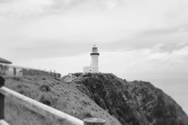
The lighthouse on the summit
Cape Byron Lighthouse was finished in 1901. It is a squat white tower built from concrete blocks, and it is often described as the most powerful lighthouse in Australia. The old keepers’ cottages sit around it, and the head keeper’s cottage now holds a small maritime display and visitor information.
You can’t miss it. It is the fixed point every other view on the headland is measured against. You’ll see it from Wategos Beach, from the Pass, and from the top of the stairs.
Captain James Cook named the cape in 1770, after the navigator John Byron. The land has a much longer story with the Arakwal people of the Bundjalung Nation. Interpretive signs along the track tell some of it.
Walking the loop
The Cape Byron Walking Track is a loop of roughly 3.7 km. Allow two hours or so with stops. Most people start from the Captain Cook Lookout car park above Clarkes Beach, then head east. The main stops are:
- The Pass: a rocky point where surfers paddle out along the headland
- Wategos Beach: a small, north-facing cove below the cliffs
- Fishermans Lookout: a clifftop platform that is good for spotting dolphins
- Most Easterly Point: the boardwalk and marker
- The lighthouse: on the summit, with views south over Tallow Beach
The track is a mix of sealed path, boardwalk and many steps, some of them steep. It climbs in full sun in places, so carry water. The shade of the rainforest sections only covers part of the way.

Whales, dolphins and the water below
Between June and November, humpback whales migrate along this coast. Because the headland sticks so far out, they often pass close enough to see from the lookouts. Look for spouts first, then the slap of a tail or a breach. Pods of bottlenose dolphins are common in the waves off the Pass all year round.
Offshore, the rocky outcrop of Julian Rocks is a marine reserve and a well-known dive site. You’ll see it from almost anywhere on the eastern side of the loop.
Getting up the headland without the parking fight
Walk in if you can. From the Byron Bay town centre, follow the beach path along Main Beach and Clarkes Beach to the Captain Cook Lookout. You’ll join the loop without ever moving the car.
If you drive, Lighthouse Road winds up to a small paid car park near the summit. It has only a limited number of spaces. The machines at the car park show the current rates. There is also paid parking near the Captain Cook Lookout.
Plan your visit around the listed hours of 9:30am to 4:30pm, which are the same every day. Give yourself enough of that window to finish the loop without hurrying the stairs.
Reading the headland like a regular
People who walk this loop often have a few habits worth copying:
- Go anticlockwise from Clarkes Beach. The climb comes early and the downhill run to Tallow and back is easier on your legs.
- Stop at Fishermans Lookout and wait. Whale spotting is patient work. Scan the water for ten minutes rather than glancing and moving on.
- Keep to the formed path. The cliff edges are unstable, and the heath is protected habitat.
- Pack binoculars in whale season. They turn a distant spout into a visible animal.
- Swim at Wategos and check the conditions first. Swim only where the beach is patrolled and conditions are calm. The water around the Pass has strong currents.
Leave the headland as you found it. It is a conservation area, and dogs are not allowed on the track.
Frequently asked questions
How long does the Cape Byron walk take?
The loop is roughly 3.7 km and takes about two hours with stops at the lookouts, Wategos Beach and the lighthouse. There are many steps, some of them steep.
When is the best time to see whales at Cape Byron?
Humpback whales migrate past between June and November. Fishermans Lookout and the Most Easterly Point are good places to watch. Dolphins are often seen off the Pass all year.
Where do I park for Cape Byron Lighthouse?
There is a small paid car park near the lighthouse at the top of Lighthouse Road, and paid parking at the Captain Cook Lookout. Rates are posted at the machines. Spaces are limited, so walking in from town along Clarkes Beach is often easier.
What are Cape Byron's opening hours?
The listed hours are 9:30am to 4:30pm, seven days a week. Plan to finish your walk within that window.
What else is nearby?
Wategos Beach and the Pass are on the loop itself. Julian Rocks marine reserve lies offshore, and Main Beach and the Byron Bay town centre are about 3 km away along the beachfront.
Plan your trip to Byron Bay
Some links above are affiliate links — if you book through them, Wander Atlas earns a small commission at no extra cost to you. It's how we keep every guide free.
Related guides
 attraction
 Cape Byron Lighthouse: Byron Bay Travel Guide (4.7★)
 hidden gem
 Natural Bridge, Springbrook National Park: Gold Coast Travel Guide
 attraction
 Snapper Rocks: Gold Coast Travel Guide (4.8★)
 trendy