Where the Black Sand Gives Out
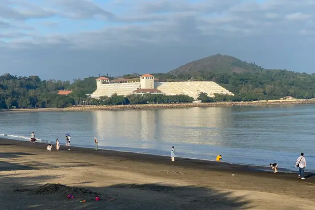
Hac Sa means “black sand.” That dark beach is where this walk begins.
Head to the eastern end of the beach, past the last of the swimmers and parasols. The sand gives way to rock, and a path climbs off into scrub and granite. That path is the Hac Sá Long Chao Kok Coastal Trail. In Chinese it is 黑沙龍爪角海岸徑, a name worth saving on your phone for asking directions.
It is still one of the quieter corners of Macau. Most visitors to Coloane come for the beach, the village and the egg tarts. Few carry on around the headland. Expect birdsong, waves on rock, and the occasional jogger, not tour groups.
Getting Out to Hac Sa
The trailhead sits at the far southeastern edge of Coloane. That makes it one of the furthest points in Macau from the Peninsula casinos, though the trip itself is simple.
- By bus: routes 21A, 25 and 26A run to the Hac Sa Beach stop. Check the DSAT route maps first, because services do change.
- By taxi: ask for Hac Sa beach (黑沙海灘). Taxis are thin on the ground out here, so think about how you’ll get back before you set off.
- On foot from the stop: walk down to the sand, turn left with the sea on your right, and keep going to the end of the beach.
From Cotai, the bus ride runs down past Coloane’s wooded hills, which is part of the point. You get a sense of how green this end of Macau stays.
What the Path Is Actually Like
This is a coastal walk, not a mountain climb. The trail stays close to the water, which is usually just below you on one side.
The ground changes as you go. Sections of paved path and steps give way to stretches where the trail crosses or runs beside bare granite. Coloane’s bedrock is granite, and the sea has worn it into rounded boulders and slabs. In places those slabs are the main thing to look at.
On the far side of the water, a clear day shows mainland China’s coastline and shipping lanes. Small boats are often out there too. Vegetation pushes in close in places, so long sleeves help with scratches and insects.
The walk is moderate for anyone used to steps. Grip matters more than fitness. Wet granite is slick, so wear proper trainers or trail shoes, not flip-flops from the beach.

The Dragon’s Claw at the End
Long Chao Kok translates roughly as “Dragon’s Claw Point.” The name tells you what the walk builds toward.
The headland is a jumble of weathered rock pushing out into the sea. People like to read the claw shape into its boulders and stone ridges. Even if the dragon never appears to you, this is where the trail earns its reputation. You stand at Coloane’s tip with open water on several sides.
It is a natural turnaround and a good place to sit. Bring something to eat; nobody sells anything out here. Keep well back from the waterline on the lower rocks. Waves can surge higher than the rest of the sea suggests, especially after rough weather.
Choosing Your Season and Light
The trail is listed as open around the clock, but treat it as a daylight walk. The path is not lit, the rocks are uneven, and phone signal can be patchy.
- October to December: the classic hiking window in Macau. Air is drier, skies are clearer and the views go furthest.
- January to March: cooler and often grey, with drizzle that makes the granite slippery.
- May to September: hot and very humid, and typhoon season too. If you go, start early and carry more water than you think you need.
Light matters on a walk this exposed. Morning is cooler and kinder on the climbs. Late afternoon brings warm side-light on the rocks, but leave yourself time to get back to the beach before dark.
Walking the Coloane Coast Responsibly
A few local habits make this walk smoother.
Watch the typhoon signals. Macau broadcasts tropical cyclone warnings on numbered signals. When Signal No. 3 or higher is up, stay off any coastal path, and the buses can stop altogether at No. 8. Check the Macao Meteorological and Geophysical Bureau (SMG) before you leave.
Pay the bus the local way. Macau buses take a Macau Pass card or exact coins, and drivers do not give change. Have your fare ready before the bus pulls in.
Take your rubbish back. There are no bins along the rocks, and anything left out here ends up in the sea.
Greet people simply. Cantonese is the everyday language. A nod or “jóu sàhn” (good morning) to passing walkers goes down well. Step aside for faster hikers on narrow stretches.
Stay on the marked route. Short cuts down to the waterline look tempting. They are where people slip.
Back on the Sand: Rounding Off the Day
The walk back drops you straight onto Hac Sa beach, and that’s the reward.
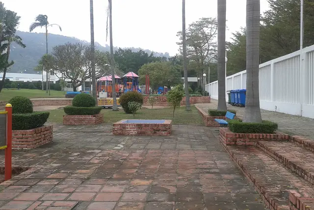
The black sand beach is a good place to rinse your feet and sit for a while. Just behind it, the Hac Sa Sports and Recreation Park has open lawns and family facilities. It works well if your group has split between hikers and beach-sitters.
For food, Fernando’s is the long-running Portuguese restaurant on the beach. Diners come to Hac Sa just for it, and its tables fill up at weekends. Coloane Village is a short bus or taxi ride west. It has the Chapel of St. Francis Xavier, waterfront lanes, and the original Lord Stow’s Bakery for egg tarts.
Together they make an easy half-day: trail in the morning, lunch by the sand, and an afternoon wander through the village.
Frequently asked questions
How do I get to the Hac Sá Long Chao Kok Coastal Trail?
Take bus 21A, 25 or 26A to the Hac Sa Beach stop on Coloane, then walk to the eastern end of the beach, where the trail leaves the sand. Check current routes on the DSAT site before you travel. Taxis can be hard to find for the return trip.
When is the best time to hike it?
October to December brings the driest air, the clearest views and the most comfortable temperatures. Summer is hot, humid and typhoon season, so start early if you go then. The trail is listed as open 24 hours, but it is unlit, so walk it in daylight.
How long does the walk take?
Most people spend about one to two hours, including time sitting on the rocks at the Long Chao Kok headland. Add time for a swim or a meal at Hac Sa beach afterwards.
Is the trail difficult?
It is a moderate coastal walk with steps, paved sections and stretches of bare granite. Fitness matters less than footing, so wear shoes with good grip, because the rock gets slippery when it's wet.
What is there to do nearby?
Hac Sa beach and the Hac Sa Sports and Recreation Park are right at the trailhead, and Fernando's Portuguese restaurant is on the beach. Coloane Village, with the Chapel of St. Francis Xavier and the original Lord Stow's Bakery, is a short ride west.
Plan your trip to Hac Sa
Macau eSIM & staying connected →
Some links above are affiliate links — if you book through them, Wander Atlas earns a small commission at no extra cost to you. It's how we keep every guide free.