A cross above the rooftops
The big cross on the slope southeast of Huaraz is the mirador. You can see it from most streets in the centre. Below it, the city spreads out as a grid of brick and concrete rooftops across the Santa River valley.
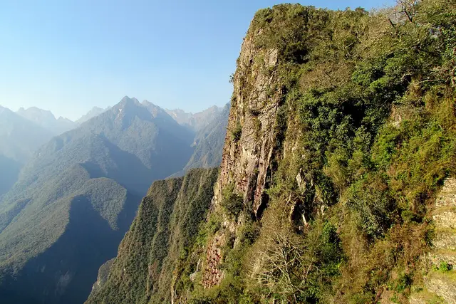
Behind the city stands the Cordillera Blanca, the world’s highest tropical mountain range, with its ice-capped summits in a line. Huascarán, Peru’s highest peak, is up the valley to the north. The browner, snowless ridges of the Cordillera Negra close off the view to the west.
It doesn’t feel like an attraction with facilities. It is a bare hilltop with a cross and a lookout, and it stays quiet compared with the trailheads that fill the tour vans every morning.
Walking up, or not
Most visitors walk up from the centre. It is the classic first-day hike for acclimatising.
- Start: Plaza de Armas, heading southeast and uphill through residential streets, then onto dirt paths.
- Time: allow roughly 1–1.5 hours up for most people still adjusting to altitude, and less coming down.
- Altitude: Huaraz sits around 3,050 m, and the mirador is several hundred metres higher. You’ll notice it on the steeper final stretch.
- Navigation: the plus code FF7P+M27 drops a pin on the right spot in map apps. The cross keeps you oriented most of the way.
- Alternative: a dirt road reaches the top, so a taxi is an option if you’re short of breath or time. Agree the fare before you get in.
Bring water, sunscreen and a layer. The sun is fierce at this altitude, and the wind on the hilltop is cold.
Going up safely
The site is listed as open 24 hours because it is an open hillside. That doesn’t make night a good time to go.
The quieter path above the last houses has a history of reported robberies of lone walkers. Advice from local guides and hostels is consistent:
- Go in a group, or hire a guide through your hostel or a trekking agency.
- Walk up and back in daylight. A morning start avoids coming down at dusk.
- Leave passports and spare cash at your lodging, and carry your phone out of sight on the outskirts.
- Ask your hostel about current conditions before setting out, since the situation changes.
Timing the mountain view
Clear skies make or break this view. The dry season, roughly May to September, gives the most reliable visibility of the Cordillera Blanca. Mornings are usually sharper than afternoons, when cloud tends to build over the peaks.
In the wet months, from about December to March, the summits can stay hidden for days. Watch the range from town at breakfast, and go up the morning the peaks are showing. Plan for 3–4 hours return on foot, including time at the top.
The mirador works well as a warm-up a day or two before bigger outings such as Laguna Churup or Laguna 69. It’s a short, real climb that tells you how your body is coping with the altitude. If the walk leaves you pounding, push the bigger hikes back a day.
Frequently asked questions
How do I get to Mirador de Rataquenua from Huaraz?
Walk southeast and uphill from the Plaza de Armas through residential streets, then follow dirt paths toward the large cross. Most people take about 1–1.5 hours. You can also take a taxi up the dirt road and walk down.
Is it safe to hike to Rataquenua?
Robberies of lone walkers have been reported on the upper path. Go in a group or with a guide, walk in daylight, leave valuables at your lodging, and ask your hostel about current conditions first.
When is the best time to visit?
Morning in the dry season, roughly May to September, gives the clearest views of the Cordillera Blanca. Afternoon cloud often covers the peaks, and the wet months from about December to March can hide them for days.
Is it a good acclimatisation hike?
Yes. It climbs several hundred metres above Huaraz's roughly 3,050 m. Many travellers do it a day or two before bigger hikes like Laguna Churup or Laguna 69.
How long should I plan for the visit?
Allow 3–4 hours return on foot from the centre, including time at the top. Going up by taxi and walking down shortens that considerably.
Plan your trip to Huaraz
Peru eSIM & staying connected →
Some links above are affiliate links — if you book through them, Wander Atlas earns a small commission at no extra cost to you. It's how we keep every guide free.