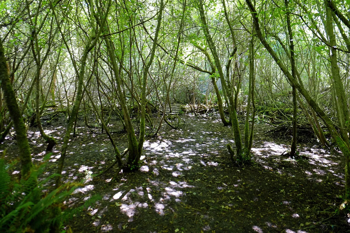
A ravine below the campus
The forest drops away fast. A minute off the Alumni Chip Trail, the wood-chip path that circles the University of Victoria, the ground falls into a steep, narrow ravine. Hobbs Creek runs along the bottom. The canopy is second-growth Douglas fir, western redcedar and bigleaf maple, with sword fern and moss on nearly everything below.
It’s a pocket of woodland, not a wilderness. You can hear the campus from the rim, then mostly lose it once you reach the creek. Few visitors know it’s here, which is why it still feels like a quiet find.
The university bought the land in the 1990s after a community campaign to keep it from being developed. Today it’s protected as a natural area.
Getting to the trailhead
The UVic Exchange is the easy start. Several BC Transit routes run there from downtown Victoria, including the 4 and the 14. From the exchange, walk east across campus toward the Alumni Chip Trail and follow it to the signed entrances into the vale.
- By car: campus parking is pay parking. Check the machines or the UVic parking page for current rules.
- From Cadboro Bay: paths climb up from the Hobbs Street side, so you can link the vale with a walk down to the beach at Cadboro-Gyro Park.
- On foot or by bike: the chip trail is flat and loops the whole campus.

Walking the vale
A loop takes 30–60 minutes. That’s longer if you stop at the creek or add the chip trail. The paths into the ravine are dirt, with roots and stretches of steps. After Victoria’s winter rains they turn slick and muddy, so wear boots or trail shoes rather than sneakers.
What to look for:
- Bigleaf maples covered in moss and licorice fern, at their greenest from late autumn through spring.
- Hobbs Creek at the ravine floor, fullest in the wet months and quieter by late summer.
- Steep ravine walls where the light comes down in shafts on clear mornings.
Google lists it as open 24 hours. The ravine has no lighting, though, and the canopy makes dusk come early down there, so plan to be out before dark. Pair the walk with Finnerty Gardens on campus, which is known for its rhododendrons in spring.
Trail manners in the vale
The ravine is a restoration area, and that shapes how people use it. Stay on the established paths. Cutting corners on the slopes erodes the banks and tramples the plants that volunteers have replanted.
- Follow the dog rules posted at the entrances, and pack out what your dog leaves.
- Leave the moss, ferns and fallen branches where they are.
- Bikes belong on the chip trail, not on the ravine footpaths.
- Step aside on narrow stretches. Runners and students use these trails as a shortcut between campus and Cadboro Bay.
Weekday mornings during university term tend to be calm, because the people walking through are mostly heading to class. If you want the creek mostly to yourself, a grey, drizzly day usually empties the trails better than any timing trick.
Frequently asked questions
How do I get to Mystic Vale by bus?
Take a BC Transit bus to the UVic Exchange. Several routes from downtown Victoria stop there, including the 4 and the 14. Then walk east across campus to the Alumni Chip Trail and follow the signs into the ravine.
How long does a walk through Mystic Vale take?
A loop down to Hobbs Creek and back takes 30–60 minutes. Add time if you continue down to Cadboro Bay or walk the full Alumni Chip Trail around campus.
Is Mystic Vale open at night?
Google lists it as open 24 hours, but the ravine has no lighting and the canopy is dense. Visit in daylight and aim to be out before dusk.
What should I wear?
Wear boots or trail shoes. The ravine paths have roots and steps, and they get muddy and slick after rain, especially from autumn through spring.
What else is nearby?
Finnerty Gardens is on the UVic campus and is known for its rhododendrons in spring. Downhill, Cadboro-Gyro Park sits on the beach at Cadboro Bay.
Plan your trip to Victoria
Canada eSIM & staying connected →
Some links above are affiliate links — if you book through them, Wander Atlas earns a small commission at no extra cost to you. It's how we keep every guide free.
Related guides
 attraction
Craigdarroch Castle: Victoria Travel Guide (4.5★)
 attraction
Miniature World: Victoria Travel Guide (4.6★)
 attraction
Fairmont Empress: Victoria Travel Guide (4.6★)
 attraction