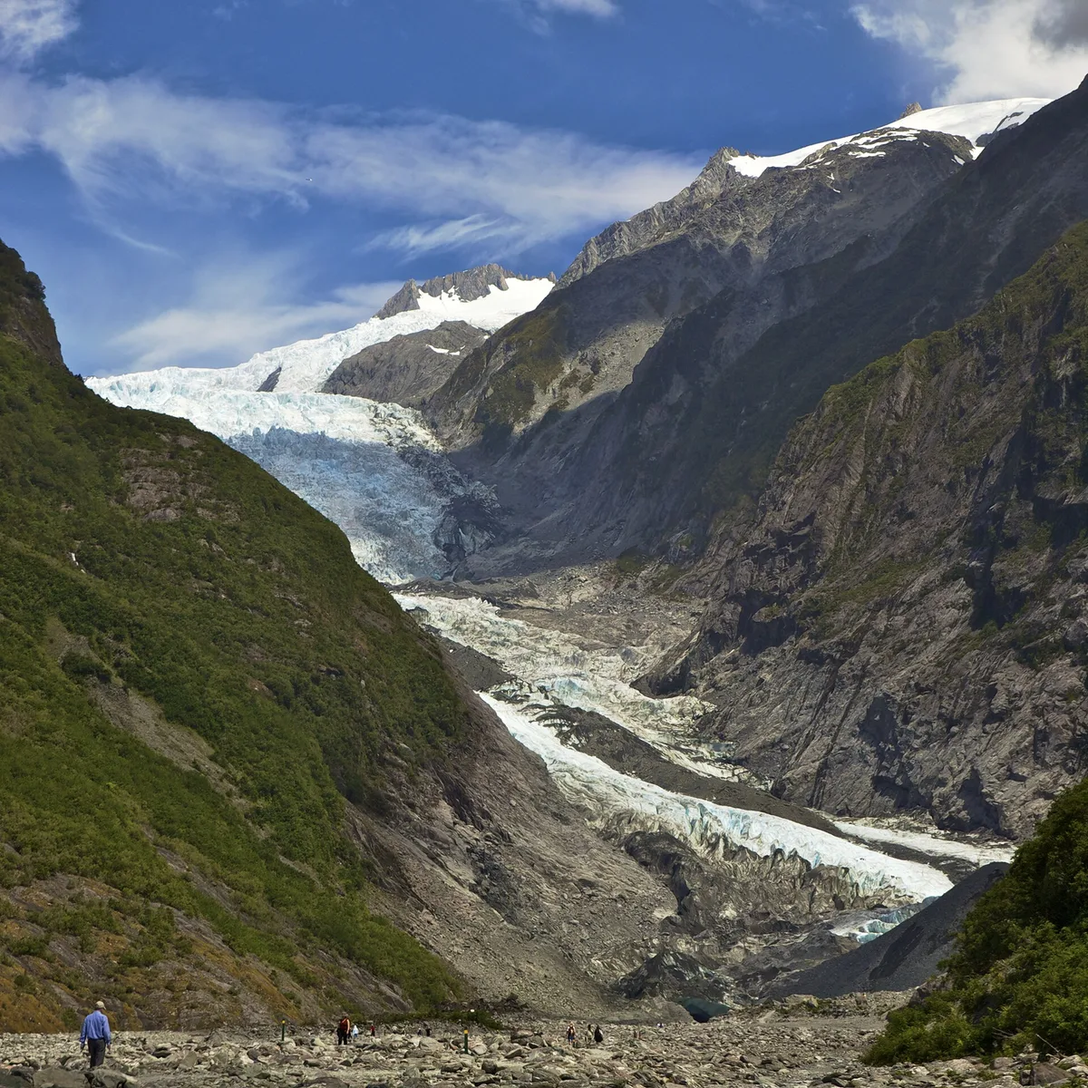
Ice spilling into rainforest
At sea level a river of ice breaks out of temperate rainforest. Franz Josef Glacier, known in Māori as Kā Roimata o Hine Hukatere, runs about 12km (7.5 miles) down from the Southern Alps. It ends in a grey, boulder-strewn valley carved by the Waiho River. Tree ferns and moss grow almost to the moraine.
The glacier sits inside Westland Tai Poutini National Park, which is part of the Te Wāhipounamu World Heritage Area. It has retreated a long way in recent decades. Signposts along the valley mark where the ice used to reach, and the gap between them and today’s terminal is the clearest climate lesson in the country.
Walking the valley
The free tracks all start from the Glacier Access Road, just south of the township off State Highway 6.
- Glacier Valley Walk: about 1.5 hours return over gravel riverbed and past waterfalls on the valley walls. It finishes at a viewpoint short of the terminal because rockfall makes the face dangerous.
- Sentinel Rock: a 20-minute return climb up a glacial knob for a framed view up the valley.
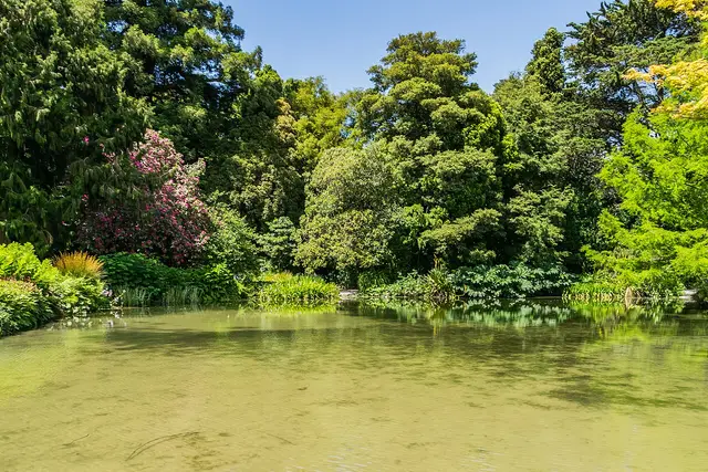
- Peters Pool: a short, flat loop to a kettle lake that holds still-water reflections of the valley.
- Roberts Point Track: about 5 hours return, with swing bridges and steep rocky sections. It’s the closest view of the ice you can get on foot.
- Alex Knob Track: the full-day climb of roughly 8 hours return, which looks down on the névé from above.

Getting onto the ice
Guided walks from the valley floor ended once the glacier’s retreat made the approach unstable. Now the only way onto the ice is a helicopter heli-hike. Operators in the township fly you up and fit you with crampons, then guides cut a route through blue ice caves and crevasse fields. Scenic flights that land on the snow at the top of the névé are the other option. Check each operator’s website for current prices.
Reading the West Coast weather
How your day goes here depends on the cloud and the river.
- Book flights for the morning. Cloud usually builds over the Alps as the day goes on, and operators cancel when visibility drops. Leave a spare day in your plans so a grounded flight can move.
- Check track status before walking. Department of Conservation (DOC) closes the valley walk after heavy rain, when the Waiho rises or rockfall risk climbs. Notices go up at the car park and on the DOC website.
- Stay behind the barriers. Ice collapses at the terminal happen without warning, and people who climb past the ropes are the reason the rules exist.
- Pack a rain shell and insect repellent. Sandflies swarm the valley floor, and the West Coast is one of the wettest places in New Zealand.
After the walk, Glacier Hot Pools in the township is the usual place to soak, set in rainforest. Fox Glacier is about 25km south on State Highway 6 if you want a second glacier valley the same day. Plan on half a day for the valley walks and a full day if you add a heli-hike.
Frequently asked questions
Can you walk onto Franz Josef Glacier?
Not from the valley floor. Guided ice walks from the valley stopped because of the glacier's retreat. The only way onto the ice is a guided helicopter heli-hike booked through an operator in the township.
How long is the Glacier Valley Walk?
About 1.5 hours return from the Glacier Access Road car park. It ends at a viewpoint short of the terminal because of rockfall risk.
What is the best time of day to go?
Morning. Cloud tends to build over the Southern Alps later in the day, and that often grounds helicopter flights and hides the upper glacier.
How far is it from Franz Josef township?
The Glacier Access Road car park is about 5km south of the township, just off State Highway 6.
What else is nearby?
Glacier Hot Pools is in the township, and Fox Glacier is about 25km south on State Highway 6. Roberts Point and Alex Knob are longer tracks with views of Franz Josef from higher up.
Plan your trip to Franz Josef
New Zealand eSIM & staying connected →
Some links above are affiliate links — if you book through them, Wander Atlas earns a small commission at no extra cost to you. It's how we keep every guide free.
Related guides
 attraction
The Church of the Good Shepherd: Lake Tekapo Travel Guide
 attraction
Puzzling World: Wanaka Travel Guide (4.5★)
 attraction
Wānaka Willow Tree: Wanaka Travel Guide (4.4★)
 attraction