
A mountain folded like a paper fan
Picture a wall of rock folded into sharp V shapes. Each fold is striped in ochre, rust, mustard, plum, cream and green. Locals call it the Cerro de los 14 Colores, the hill of fourteen colours, and from the viewpoint the whole range runs across your field of vision with nothing in front of it. Whole sections of the slope look printed on.
The colours come from layers of limestone and other sediments, each laid down with different minerals and then buckled upward. The range reaches 4,761 m at its highest point. From the lookout you see the folds repeated down the ridge, row after row, which is why photos so rarely show the full scale.
Hornocal is well known and appears on most Quebrada de Humahuaca itineraries. Don’t expect solitude. What it does have is space: the viewing area is a broad open shoulder of land, and people spread out along it.
Ruta Provincial 73, out of Humahuaca
The trip starts in Humahuaca town, at about 2,940 m. You leave by crossing the bridge over the Río Grande on the east side of town, then pick up Ruta Provincial 73. It’s a gravel road that switchbacks up through dry, scrubby hills for roughly 25 km.
Most vehicles take about an hour each way. The surface is fine for a careful driver in a normal car in the dry months, but loose gravel and blind bends call for slow speeds. From December to March, summer rains can wash out sections or turn them to mud. Ask in town about conditions before setting off.
Partway up, you may be asked to pay a community access fee. The local community collects it, and the current amount is shown where you pay. Have cash in Argentine pesos ready, since there’s no card machine on a mountainside.
The afternoon light rule
The striped face of Hornocal looks west. That one fact decides the timing of your whole visit.
In the morning the sun sits behind the ridge, so the folds stay in shadow and the colours look flat and grey-brown. From early afternoon the light swings round onto the face. The bands sharpen, the reds deepen, and the zigzags throw shadows that make the folds look three-dimensional. Tour drivers in Humahuaca time their departures for this, and you should too.
Late afternoon gives the warmest tones, but it also gets cold fast once the sun drops. Plan to be heading down before dark. RP73 is no road for driving at night.
What 4,350 metres does to you
The viewpoint sits around 4,350 m, higher than any peak in the Alps. Walking even a short way can leave you breathless, and from the parking area you’ll probably want to go further down the path for a lower angle.
- Acclimatise first. Spend at least a night in Humahuaca, Tilcara or Purmamarca before going up.
- Coca leaves. Sold in markets across the Quebrada. People tuck a wad in their cheek or drink it as mate de coca.
- Water and snacks. There are no reliable services at the top.
- Layers, a windproof jacket and a hat. The wind on the shoulder is strong and the sun is fierce at this altitude.
- Sunscreen and sunglasses. The UV up here is not mild.
If you get a pounding headache or nausea, the cure is to go down. Don’t push through it.
Riding up with a Humahuaca driver
Most visitors don’t drive themselves. Drivers and small agencies wait around Humahuaca’s main plaza and near the bridge, offering trips in 4x4s and pickups. Some run shared departures that leave once enough passengers turn up. Others will take a private group.
Agree on three things before you get in: the departure time (early afternoon is the one you want), how long you’ll have at the viewpoint, and whether the community fee is included. Pay in cash. An hour at the top is a normal stop and gives you time to walk down the path and back up slowly.
Drivers on this route know the road and the weather. If one says the light is wrong or the road is bad today, believe them. Rebook for tomorrow rather than going up for a grey view.
Before and after in Humahuaca town
Spend your morning in town. The light on the mountain won’t be good until later anyway, and Humahuaca deserves a few hours.
- Monumento a la Independencia: a large bronze monument at the top of a broad stone staircase above the plaza.
- The Cabildo: the town hall on the plaza. At noon, a carved figure of San Francisco Solano comes out of its clock tower to give a blessing, and people gather below to watch.
- The cathedral: a whitewashed colonial church facing the plaza.
- Lunch: a plate of humita, tamales or a llama stew from one of the eateries on the streets off the plaza, then head up for the afternoon light.
Stringing Hornocal into the Quebrada
Hornocal works best as one stop on a trip along the Quebrada de Humahuaca, the valley inscribed as a UNESCO World Heritage Site in 2003. South along Ruta Nacional 9 you reach Uquía, whose small church holds the paintings of armed angels known as the ángeles arcabuceros. Further on is Tilcara, with the rebuilt pre-Hispanic hilltop fort of the Pucará de Tilcara.
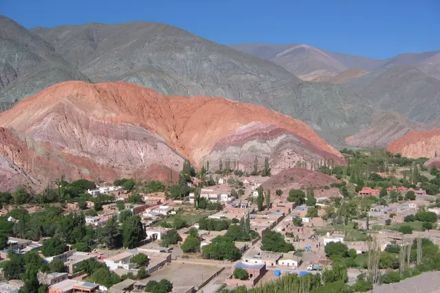
Further south again, Purmamarca sits beneath the Cerro de los Siete Colores, a smaller striped mountain. Seeing both in one trip shows you how different they are. Purmamarca’s colours sit right next to the village, while Hornocal’s take a climb to reach and fill the whole skyline.
For a longer detour, the road to Iruya branches off north of Humahuaca. It crosses a high pass before dropping down to a village built on a steep slope.
Frequently asked questions
How do I get to Serranía de Hornocal from Humahuaca?
Cross the bridge over the Río Grande on the east side of Humahuaca and follow the gravel Ruta Provincial 73 for about 25 km to the viewpoint. Most vehicles take around an hour each way. If you don't want to drive, hire a 4x4 or pickup driver near the main plaza or the bridge.
What is the best time of day to see Hornocal?
The afternoon. The striped face looks west, so it stays in shadow in the morning and only lights up from early afternoon. Late afternoon gives the warmest colours, but leave time to get down before dark.
Will the altitude be a problem?
It can be. The viewpoint is around 4,350 m. Spend at least a night in Humahuaca or elsewhere in the Quebrada first, walk slowly, drink water and consider coca tea. If a headache or nausea sets in, go down.
Can I drive there myself, and when is the road worst?
In the dry months a careful driver can manage RP73 in a normal car, but it's loose gravel with tight bends. Summer rains from December to March can wash out sections, so check conditions in Humahuaca before you go.
How long should I plan for the trip?
Allow about three hours from Humahuaca: an hour up, an hour or so at the viewpoint and an hour back. Spend the morning in town and leave in the early afternoon.
Plan your trip to Humahuaca
Argentina eSIM & staying connected →
Some links above are affiliate links — if you book through them, Wander Atlas earns a small commission at no extra cost to you. It's how we keep every guide free.
Related guides
 attraction
Cerro de los Siete Colores: Purmamarca Travel Guide (4.8★)
 attraction
Purmamarca Jujuy: Travel Guide (4.8★)
 hidden gem
Hito Tres Fronteras (Argentina): Puerto Iguazu Travel Guide
 hidden gem