
A mountain at the end of the street
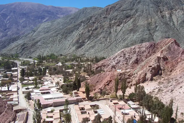
The hill closes off the village. Purmamarca is a grid of low adobe houses and dirt-edged streets, and Cerro de los Siete Colores rises behind them. From the main plaza you only need to look up past the rooftops to see it.
That closeness is what makes the place unusual. Most of the Andes’ big landscapes call for a long drive or a hard hike. Here you can stand beside a craft stall and look straight at a slope striped in rust, ochre, cream, purple-grey and a dusty green. The colours sit in tilted bands, as if the hill were cut from layered rock and tipped on its side.
It is well known and well visited, the postcard image of the whole Quebrada de Humahuaca. In 2003 UNESCO listed the valley as a World Heritage Site. Expect other people with cameras, and plan around them.
Why the hill is striped
Each colour comes from a different layer of rock. Over millions of years, sediments from lakes, rivers and shallow seas settled here one on top of another. Each layer carried its own minerals, and each was laid down in different conditions.
Then the Andes rose and pushed the flat layers up at steep angles, so now they lie exposed side by side. Iron oxides give the reds and pinks. Other minerals and finer clays produce the paler cream and greenish bands. Whether you can count exactly seven depends on the light and on how generous you are feeling.
Catching the hill in morning light
Timing matters more here than at almost any other viewpoint in the region. The hill sits on the west side of the village, so its face points east. Morning sun hits it straight on, and that is when the bands look sharpest and most separate.
By afternoon the sun has moved behind the ridge. The face drops into shade and the colours flatten into a duller brown-red. Photographers who arrive late are often disappointed.
Staying the night in Purmamarca is the easiest way to be there at the right hour. Day-trippers from San Salvador de Jujuy usually arrive mid-morning or later. Staying over lets you see the slope in early light from a quiet street, before the tour vans pull in.
Two ways to see it on foot
You don’t need a guide or any gear. There are two classic approaches, and most visitors do both.
- Cerro de la Cruz: a short, steep path up the small hill topped by a cross on the edge of the village. The climb takes about 15–20 minutes. From the top you look across the rooftops to the full striped face, and this is the framing in most photographs.
- Paseo de los Colorados: a loop of roughly 3 km on an unpaved track around the back of the village. It runs between eroded red rock walls and pinnacles and gives side-on, close views of the coloured layers. Allow an hour or more at a walking pace. Cars can drive it too, but it is far better on foot.
There’s very little shade on either route. Midday sun at this altitude is strong, so carry water, a hat and sunscreen even in winter.

Getting to Purmamarca
Purmamarca sits about 65 km north of San Salvador de Jujuy, the provincial capital. Take Ruta Nacional 9 up the Quebrada, then turn west at the junction onto Ruta Nacional 52 for the last few kilometres. On a paved road the drive takes a little over an hour.
Regular buses leave from San Salvador de Jujuy’s bus terminal for Purmamarca and the other Quebrada towns. From Salta, most travellers either rent a car or join an organised day tour. Driving gives you the most freedom with timing, which matters for the morning light.
The village is compact. Once you’re there, everything here is walkable from the plaza.
Moving through the village at 2,300 metres
Purmamarca sits at roughly 2,300 m, high enough that a walk up Cerro de la Cruz can leave you short of breath if you’ve come up from sea level. Walk slowly, drink plenty of water and go easy on alcohol the first evening. Many locals chew coca leaves or drink coca tea for the altitude. You’ll see both sold around town, and both are legal and normal in Jujuy.
Some habits help:
- The plaza market: stalls around the main square sell woven ponchos, llama-wool textiles and ceramics. Polite bargaining is normal. Bring cash, because not every stall takes cards and cash machines are scarce in small Quebrada villages.
- Photographing people: many vendors and residents are of Indigenous Andean heritage. Ask before you photograph someone, and accept a no.
- The church: the adobe Iglesia de Santa Rosa de Lima stands beside the plaza, with a ceiling made from cardón cactus wood. It’s a working church, so dress modestly and keep your voice low.
- Staying on the paths: the coloured slopes are soft, crumbling rock. Climbing them damages the formations and is unsafe, so stick to the marked routes.
In August, many communities in the region mark the month of Pachamama (Mother Earth) with offerings. If you come across a ceremony, watch quietly from a respectful distance.
Onward from Purmamarca
The hill is usually one stop on a longer route. Purmamarca makes a good base for the rest of the region.
- Salinas Grandes: continue west on Ruta 52 over the switchbacks of the Cuesta de Lipán, which climbs above 4,000 m. You come down onto a vast white salt flat, around 60 km from the village.
- Tilcara: north on Ruta 9, home to the Pucará de Tilcara, a reconstructed pre-Hispanic hilltop fortress.
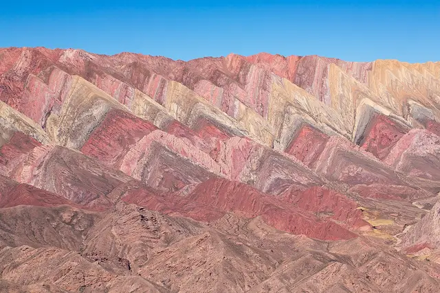
- Humahuaca: further up the valley, with its hilltop independence monument and cobbled centre. Beyond it lies the Serranía de Hornocal, a ridge with even more colour bands.
A good loop is the Cerro de los Siete Colores at dawn, then the salt flats at midday and Tilcara by evening. That covers the best of the southern Quebrada in one full, high-altitude day.
Frequently asked questions
What time of day is best to see Cerro de los Siete Colores?
Morning. The hill's face points east, so morning sun lights it directly and the colour bands look sharpest. By afternoon the face falls into shade and the colours look flatter.
How do I get to Purmamarca from San Salvador de Jujuy?
Drive about 65 km north on Ruta Nacional 9, then turn west onto Ruta Nacional 52 for the last few kilometres. It takes a little over an hour. Regular buses also run from the San Salvador de Jujuy bus terminal.
How long should I spend there?
Plan 2–3 hours for the Cerro de la Cruz viewpoint, the roughly 3 km Paseo de los Colorados loop and the plaza. Staying overnight lets you catch the early light before the day tours arrive.
Is the altitude a problem?
Purmamarca sits at about 2,300 m, so short climbs can leave you breathless. Walk slowly and drink plenty of water. If you go on to Salinas Grandes, the road over the Cuesta de Lipán climbs above 4,000 m.
What else is near Purmamarca?
Salinas Grandes salt flat lies west on Ruta 52. Tilcara, with its Pucará fortress, and Humahuaca, gateway to the Serranía de Hornocal, are north along Ruta 9 in the Quebrada de Humahuaca.
Plan your trip to Purmamarca
Argentina eSIM & staying connected →
Some links above are affiliate links — if you book through them, Wander Atlas earns a small commission at no extra cost to you. It's how we keep every guide free.
Related guides
 attraction
Purmamarca Jujuy: Travel Guide (4.8★)
 attraction
San Bernardo's Hill: Salta Travel Guide (4.7★)
 hidden gem
Serranía de Hornocal: Humahuaca Travel Guide (4.9★)
 attraction