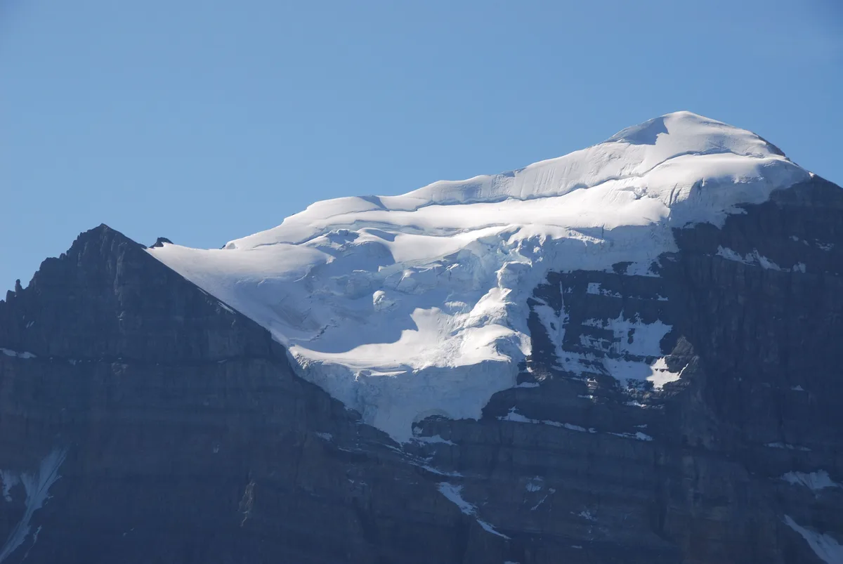
The wall above Moraine Lake
Look up from almost anywhere around Lake Louise and Mount Temple fills the sky. Its north face is a dark sweep of rock and hanging ice. Its summit is a rounded snow cap at 3,544 m (11,627 ft), the highest point in the Lake Louise group.
The peak was named in 1884 for Sir Richard Temple, who led a British Association for the Advancement of Science visit to Canada. In 1894 Walter Wilcox, Samuel Allen and L.F. Frissell climbed it. Theirs was the first recorded ascent of a peak over 11,000 feet in Canada.
That history matters because the easy side really is easy, in mountaineering terms. Walkers have been going up the southwest slopes for well over a century. The north face, on the other hand, is a serious alpine climb and belongs to roped teams.
Reaching Moraine Lake without your own car
The standard route starts at Moraine Lake, 14 km up a side road from Lake Louise village. Private vehicles have been barred from Moraine Lake Road since 2023. Plan around that from the start.
Your options:
- Parks Canada shuttle from the Lake Louise Park and Ride at the Lake Louise Ski Resort. Seats are booked through the Parks Canada reservation system.
- Roam Transit buses, which link the Lake Louise area and Banff town.
- Licensed commercial operators, some of which run very early departures for hikers.
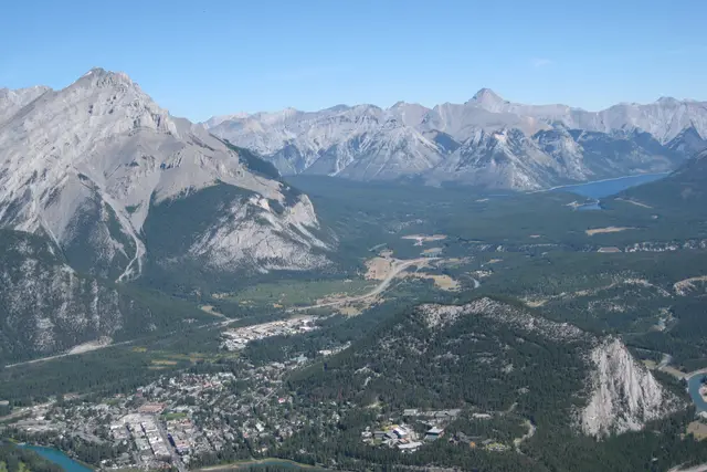
Lake Louise village sits on the Trans-Canada Highway (Highway 1), about 60 km west of the town of Banff and roughly two hours’ drive from Calgary. You need a valid national park pass to stop anywhere in the park. Current fees and shuttle schedules are on the Parks Canada website.
Larch Valley to Sentinel Pass
The first stretch is a well-graded trail, and it is busy. From the Moraine Lake lodge area, switchbacks climb through spruce and fir to Larch Valley. The meadows there are ringed by the Valley of the Ten Peaks.
Alpine larches dominate this valley. They are deciduous conifers, and for a few weeks in mid to late September their needles turn gold. Those are the most crowded weeks of the year on this trail.
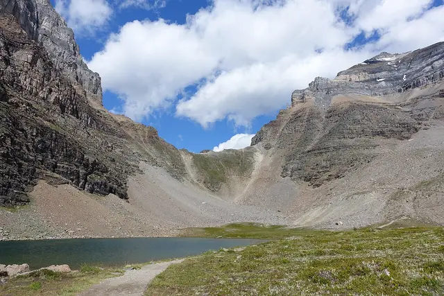
Past a pair of small tarns, the path zigzags up scree to Sentinel Pass at about 2,611 m. That makes it one of the highest points reached by a maintained trail in the Canadian Rockies. Many people stop here, look down into Paradise Valley and turn back. For you, it is the base camp of the day.
The southwest ridge: what the scramble asks
Above the pass the trail ends and the mountain starts. Expect roughly 900 m more of climbing on loose scree, ledges and rubble. Overall you gain about 1,700 m from Moraine Lake, which is what makes the day long.
Guidebooks rate it a moderate scramble. You will use your hands in places, especially at the rock bands partway up, where cairns and worn paths show the usual way through. A helmet is sensible. Many parties are moving on the same slope, and loose rock comes down.
The top is a broad snow-and-scree dome. The north side drops away to the glaciers above Paradise Valley. Stay well back from the edge, because cornices can overhang the void.
Don’t treat the summit as the finish. The descent is on the same loose ground with tired legs, and most accidents on scrambles like this happen on the way down.
The group-of-four rule and other things people here get right
Grizzlies use Larch Valley and Paradise Valley heavily. In summer and autumn, Parks Canada usually enforces a group-access restriction: hikers must move in tight groups of four or more. Wardens do patrol, and fines apply. Check the current bulletin on the Parks Canada site before you go.
How experienced scramblers handle the day:
- Team up before the trailhead. Solo hikers often match up at the start, but you can’t count on it. Arrange your group in advance.
- Carry bear spray on a hip belt or chest strap. Spray buried in a pack is useless when you need it.
- Start at first light. On summer afternoons, thunderstorms build quickly over the Continental Divide, and the upper ridge is no place to be in lightning. An early start also gets you ahead of the larch-season crowds below the pass.
- Set a turnaround time and keep to it, whether or not you have reached the top.
- Leave a trip plan with someone at home. AdventureSmart has a template.
Mobile coverage is patchy above the pass. Banff National Park is covered by Parks Canada Visitor Safety, but a satellite messenger is worth packing.
When the mountain is in condition
The scramble season is short. Snow usually lingers on the upper ridge into July, and then the route needs an ice axe and real skill. The usual window runs from late July through September.
By late September, early storms can lay fresh snow and ice on the rock bands. One cold night can turn an easy ledge into a hazard. The Lake Louise visitor centre and recent trip reports are the best guide to current conditions.
Bring more water than you think you need. There is no reliable water above the Larch Valley tarns, and the scree holds the heat on clear days.
Seeing Mount Temple without climbing it
Most visitors know this peak from below, and the views are worth the trip on their own:
- Larch Valley and Sentinel Pass: the face of the mountain up close, with no scrambling.
- Moraine Lake rockpile: the classic view of the Ten Peaks, with Temple’s shoulder to the north.
- Paradise Valley: a quieter approach from the Lake Louise side, under the north face.
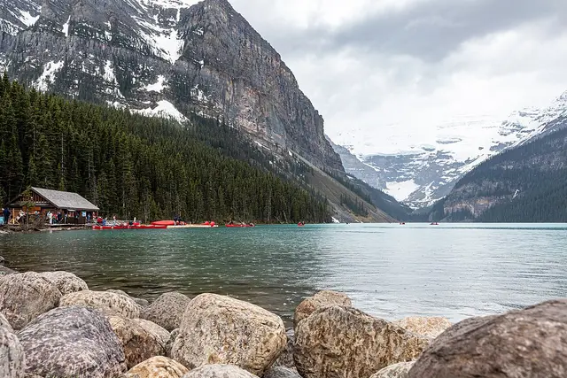
- Lake Louise lakeshore and Fairview Lookout: the summit dome over the trees to the south.
If the full ascent is too much, Sentinel Pass on its own makes a strong half day. Plan on about 4–6 hours return from Moraine Lake. You still get the larches, the tarns and a clear view of the route you would have climbed.
Frequently asked questions
How do I get to the Mount Temple trailhead?
The standard route starts at Moraine Lake. Private cars are no longer allowed on Moraine Lake Road, so take the Parks Canada shuttle from the Lake Louise Park and Ride, a Roam Transit bus or a licensed commercial operator. Shuttle seats are reserved through Parks Canada.
How long does it take to scramble Mount Temple?
Most fit parties take 8–12 hours return from Moraine Lake. That covers about 1,700 m of climbing and descending via Larch Valley and Sentinel Pass.
When is the best time to climb Mount Temple?
Usually late July through September, once snow has melted off the upper ridge. Mid to late September brings golden larches but also the busiest trail and the risk of early snow on the rock bands.
Do I need climbing gear or a guide?
The southwest route is a non-technical scramble, so no ropes are needed in dry conditions. You still need experience on loose terrain, a helmet, sturdy boots and bear spray. With snow on the route, an ice axe and the skill to use it become essential. The north face is a technical alpine climb.
Are there group-size rules on the route?
Usually, yes. Parks Canada often requires hikers in the Larch Valley and Sentinel Pass area to travel in tight groups of four or more during grizzly season. Check the current restriction on the Parks Canada website before you go.
Plan your trip to Lake Louise
Canada eSIM & staying connected →
Some links above are affiliate links — if you book through them, Wander Atlas earns a small commission at no extra cost to you. It's how we keep every guide free.