
Terraces before the drop
Chivay sits at roughly 3,600 metres. From its plaza, the Colca valley opens west in steps of stone terracing, much of it pre-Inca, still farmed and still green after the rains. The canyon proper deepens beyond the town, eventually cutting more than 3,000 metres below the surrounding peaks, around twice the depth of the Grand Canyon.
This is not a quiet secret. Colca is one of southern Peru’s most visited natural sights, mostly by tour vans from Arequipa. The trick is timing and pace, not finding somewhere nobody knows.
The climb from Arequipa
The road is part of the trip. From Arequipa it’s about three to four hours by bus or van, climbing through the Reserva Nacional Salinas y Aguada Blanca. Wild vicuñas graze close to the tarmac here, and herds of alpaca and llama graze in the high grassland.
The highest point is the Patapampa pass, near 4,900 metres. Its Mirador de los Volcanes is a field of small stacked-stone cairns with a line of snow-capped volcanoes behind. Then the road drops toward Chivay, and the air feels thicker again.
Public buses leave from Arequipa’s Terminal Terrestre. Most visitors join a one- or two-day tour that stops at these viewpoints along the way.
Cruz del Cóndor at mid-morning
The condors are why most people come. Cruz del Cóndor is a railed stone viewpoint about 40 km past Chivay, roughly an hour and a half by road. The canyon walls fall away sharply beneath it, with the Colca River far below.
Andean condors roost on the cliffs overnight. As the sun warms the rock, thermals rise and the birds lift off, often gliding close enough to see the white ruff at the neck. Morning, broadly 8am to 10am, is the classic window, and tours schedule around it.
Sightings are never guaranteed. They tend to be more reliable in the dry months. In the wet season, roughly January to March, low cloud can fill the gorge.

Villages along the rim
The road between Chivay and Cabanaconde passes a string of small towns, each with a whitewashed colonial church on its plaza:
- Yanque, with its square where traditional dances are often performed for morning tour groups
- Maca, a quick stop with a church and craft stalls
- Pinchollo, near a roadside geyser-steam vent and terrace views
- Cabanaconde, the trekking base at the canyon’s deeper end
Watch the hats. Collagua women traditionally wear tall white hats, while Cabana women wear flat embroidered ones. The embroidery, bright and dense with flowers, also appears on the skirts and vests sold in Chivay’s market.
Back near Chivay, the La Calera hot springs offer outdoor thermal pools by the river. They’re the standard way to end a day of high-altitude travel.
Down to Sangalle
For those with legs and lungs, the canyon floor is reachable on foot. The usual route starts in Cabanaconde and drops steeply on a dusty switchback path to the Sangalle oasis. There, small lodges with swimming pools sit among palms beside the river.
Most people do it over two or three days. The descent is hard on the knees; the climb back out is the real effort, often begun before dawn to beat the sun. Mules can be hired in Cabanaconde for the ascent if your body says no.
Pacing yourself at 3,600 metres
Altitude shapes every decision here. These habits make the trip work:
- Sleep in Chivay first. Coming straight from sea level and trekking the next morning is how people get sick. Arequipa, at around 2,300 metres, is a sensible stop beforehand.
- Drink mate de coca. Coca-leaf tea is served in most hotels and cafés in the valley. Locals drink it as a matter of course.
- Carry your boleto turístico. A tourist ticket is required for the Colca area and is checked at a roadside control on the way in. Tours usually collect for it; the current rate is posted at the checkpoint.
- Carry small notes in soles. Village stalls, the market and hot-spring kiosks run on cash.
- Ask before photographing people. Women in traditional dress, sometimes with an alpaca or hawk, pose at viewpoints and expect a tip for photos.
At Cruz del Cóndor, everyone wants the railing at the same moment. Walk a few minutes along the path from the main platform; there are quieter ledges with the same view of the thermals.
Layers matter too. Early mornings at the pass are freezing, while midday in the canyon can be hot under a strong sun. Bring a hat and sunscreen alongside the fleece.
Frequently asked questions
How do I get to Colca Canyon from Arequipa?
Buses run from Arequipa's Terminal Terrestre to Chivay, about three to four hours over the Patapampa pass. Most visitors book a one- or two-day tour instead, which covers the viewpoints and Cruz del Cóndor.
When is the best time to see condors?
Morning, broadly 8am to 10am, at Cruz del Cóndor, when thermals lift the birds out of the canyon. The dry season, roughly May to October, usually gives clearer skies and more reliable sightings.
How many days do I need?
Two days is the comfortable minimum: one to reach Chivay and acclimatise, one for Cruz del Cóndor and the villages. Add one or two more to trek from Cabanaconde down to the Sangalle oasis.
Will the altitude be a problem?
It can be. Chivay is around 3,600 metres and the road crosses a pass near 4,900. Spend time in Arequipa first, take the first day slowly and drink coca tea, which is widely served.
Do I need a ticket to visit?
Yes, a boleto turístico is required and is checked at a control point on the road into the valley. Tours usually handle it; the current price is posted at the checkpoint.
Plan your trip to Chivay
Peru eSIM & staying connected →
Some links above are affiliate links — if you book through them, Wander Atlas earns a small commission at no extra cost to you. It's how we keep every guide free.
Related guides
 attraction
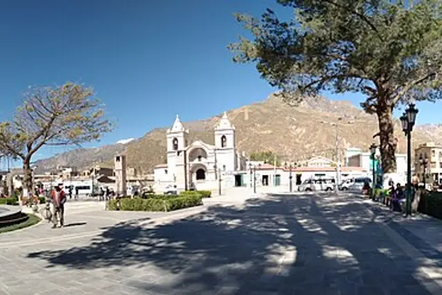
Plaza de Armas de Chivay: Travel Guide (4.4★)
 attraction
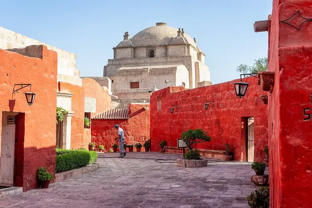
Santa Catalina Monastery: Arequipa Travel Guide (4.7★)
 attraction
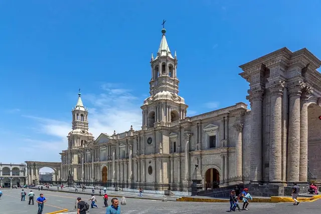
Basilica Cathedral of Arequipa: Travel Guide (4.7★)
 attraction